Method Visual provides survey-accurate visual simulations (also referred to as photo simulations or verified views) to aid the communication of development proposals during resource consent proceedings and public consultation. Visual simulations differ from concept and marketing visualisations in that they are non-emotive, as factual as possible with the information available, and follow a verifiable and repeatable process.
Visual simulations are prepared in accordance with the New Zealand Institute of Landscape Architects: Visual Simulations, Best Practice Guide 10.2, and involve accurately placing 3D modelled and rendered representations of the proposed structures and/or landscape elements into optically correct panoramic photographs, using camera control points verified by a licensed surveyor, allowing a direct comparison between existing and proposed photographic views.
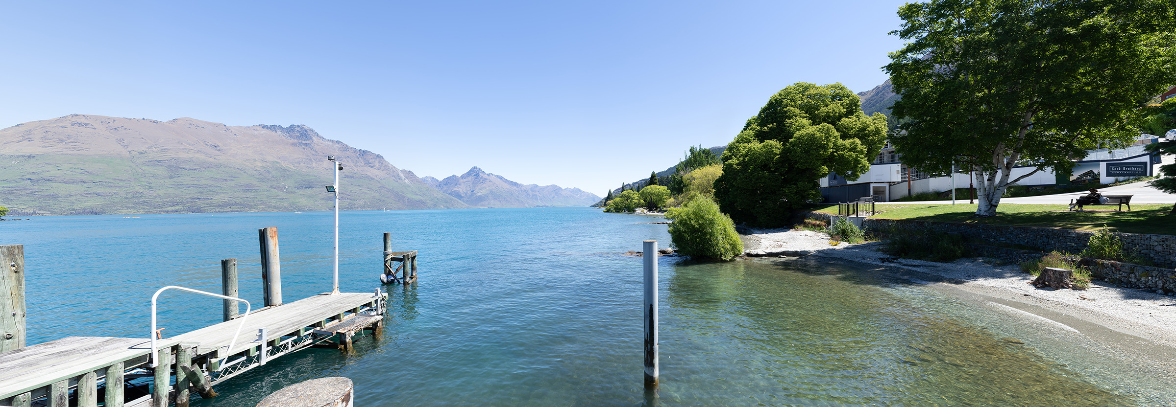
EXISTING VIEW
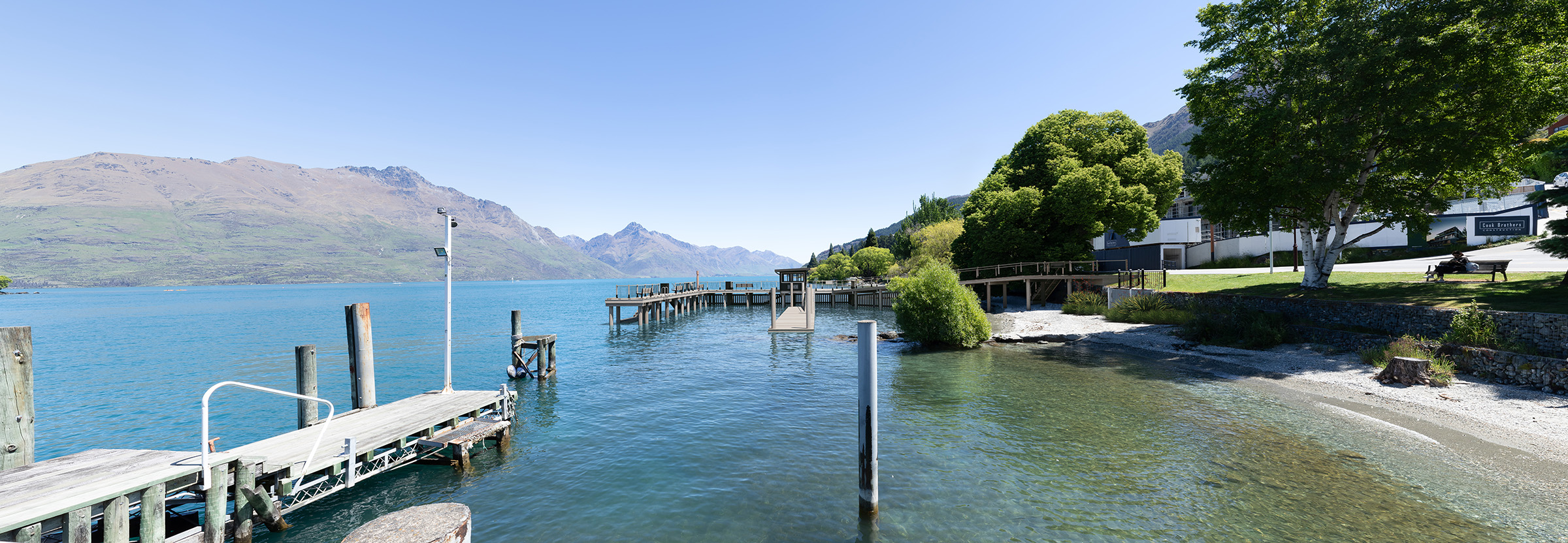
PROPOSED VIEW
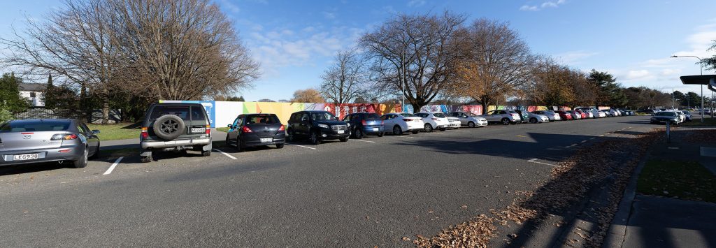
EXISTING VIEW
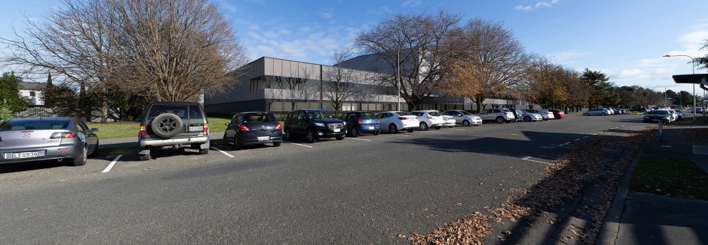
PROPOSED VIEW